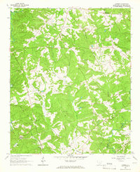
1964 Map of Latimer
USGS Topo · Published 1966About this map
Brownlee Crossroads and the settlement of Latimer anchor this mid-1960s map of Abbeville County, defined by the winding paths of the Rocky River and Little River. The landscape is a network of rural routes and family-named landmarks, such as Powers Cem and St Johns Cem, reflecting generations of local residency. A prominent Lowndesville Lookout Tower stands over the northern wooded tracts, while the dual presence of the Atlantic Coast Line and Seaboard Air Line railroads illustrates the importance of rail transit to the regional economy. Numerous small congregational sites like Midway Ch and Jacobs Chapel are scattered throughout the hills, often accompanied by burial grounds like the Old Rocky River Cem. These features, alongside drainage systems like Gill Creek and McKenley Creek, provide a detailed view of the rural South Carolina Piedmont before modern industrial expansion.
Find a feature on this map
31 named features on this map. Tap any name to fly to it.
Don’t see what you’re looking for? This feature index may not catch every label — zoom into the map to look around manually.
Map Details
Editions of this 1964 Latimer Map
This is the sole edition of this map. No revisions or reprints were ever made.
Other maps of this area

1892 · Abbeville
USGS Topo · 1:125,000

1893 · Elberton
USGS Topo · 1:125,000

1948 · Abbeville West
USGS Topo · 1:24,000

1949 · Abbeville
USGS Topo · 1:24,000

1949 · Calhoun Creek
USGS Topo · 1:24,000

1954 · Greenville
USGS Topo · 1:250,000

1958 · Greenville
USGS Topo · 1:250,000

1964 · Iva
USGS Topo · 1:24,000

1964 · Antreville
USGS Topo · 1:24,000

1964 · Lowndesville
USGS Topo · 1:24,000