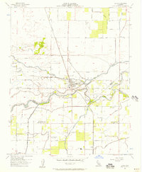
1953 Map of Laton
USGS Topo · Published 1957About this map
Laguna de Tache land grants and intensive irrigation define the landscape of the San Joaquin Valley near the border of Fresno and Kings counties during the early 1950s. The Kings River flows through the southern half of the sheet, supported by a sophisticated network of water management features including the Grant Canal, Crosscut Canal, and John Dutch Slough. This system enabled the agricultural development seen in the surrounding small settlements and school districts.
Find a feature on this map
36 named features on this map. Tap any name to fly to it.
Don’t see what you’re looking for? This feature index may not catch every label — zoom into the map to look around manually.
Map Details
Editions of this 1953 Laton Map
3 editions found
Other maps of this area

1924 · Riverdale
USGS Topo · 1:31,680

1924 · Selma
USGS Topo · 1:31,680

1924 · Conejo
USGS Topo · 1:31,680

1925 · Caruthers
USGS Topo · 1:31,680

1926 · Hanford
USGS Topo · 1:31,680

1926 · Burris Park
USGS Topo · 1:31,680

1927 · Laton
USGS Topo · 1:31,680

1927 · Remnoy
USGS Topo · 1:31,680

1927 · Riverdale
USGS Topo · 1:31,680

1927 · Lemoore
USGS Topo · 1:31,680