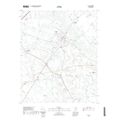
2020 Map of Latta
USGS Topo · Published 2020About this map
Latta and Sellers anchor this South Carolina landscape, where the flat coastal plain transitions into dense wetland systems. The terrain is defined by numerous depressions and watercourses, including the notable Ellerbe Bay and the winding reaches of Catfish Swamp. This 2020 survey documents a dense network of family and community burial grounds that reveal the area's deep genealogical roots, from the Catfish Creek Baptist Church Cem in the north to the Moody Cem and Powers Cem further south. The map illustrates how local life is organized around these rural crossroads and the many drainage basins like Pigeon Bay and Catfish Bay that intersect the agricultural fields. From the larger settlement at Forrest Hills to the outlying Temperance Hill, the survey provides an intricate view of the land's hydrology and the established road network that connects these long-standing Pee Dee region communities.
Find a feature on this map
146 named features on this map. Tap any name to fly to it.
Don’t see what you’re looking for? This feature index may not catch every label — zoom into the map to look around manually.
Map Details
Editions of this 2020 Latta Map
This is the sole edition of this map. No revisions or reprints were ever made.
Other maps of this area

1940 · Florence East
USGS Topo · 1:62,500

1943 · Gum Swamp
USGS Topo · 1:62,500

1945 · Florence East
USGS Topo · 1:62,500

1946 · Mullins
USGS Topo · 1:24,000

1947 · Marion
USGS Topo · 1:24,000

1947 · Mullins
USGS Topo · 1:24,000

1953 · Florence
USGS Topo · 1:250,000

1954 · Florence
USGS Topo · 1:250,000

1959 · Fork
USGS Topo · 1:24,000

1960 · Latta
USGS Topo · 1:24,000