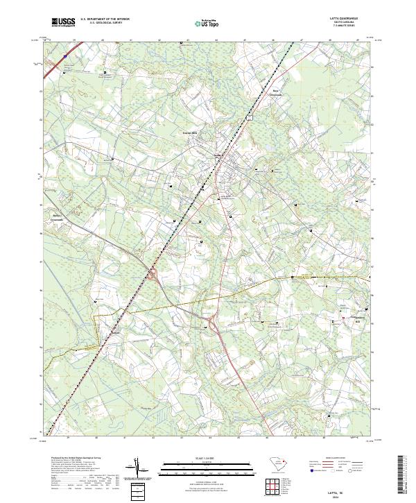
2024 Map of Latta
USGS Topo · Published 2024About this map
Latta serves as the central hub for this portion of the Pee Dee region, where the CSX railroad corridor anchors the local economy. The landscape is defined by its numerous "bays"—distinctive elliptical depressions such as Pigeon Bay, Ellerbe Bay, and Catfish Bay—interspersed with winding water bodies like Stackhouse Creek and Cud Swamp. These natural features have historically shaped the layout of settlements and agriculture across the Dillon and Marion county line.
Find a feature on this map
159 named features on this map. Tap any name to fly to it.
Don’t see what you’re looking for? This feature index may not catch every label — zoom into the map to look around manually.
Map Details
Editions of this 2024 Latta Map
This is the sole edition of this map. No revisions or reprints were ever made.
Other maps of this area

1940 · Florence East
USGS Topo · 1:62,500

1943 · Gum Swamp
USGS Topo · 1:62,500

1945 · Florence East
USGS Topo · 1:62,500

1946 · Mullins
USGS Topo · 1:24,000

1947 · Marion
USGS Topo · 1:24,000

1947 · Mullins
USGS Topo · 1:24,000

1953 · Florence
USGS Topo · 1:250,000

1954 · Florence
USGS Topo · 1:250,000

1959 · Fork
USGS Topo · 1:24,000

1960 · Latta
USGS Topo · 1:24,000