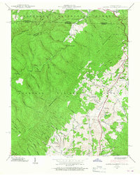
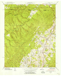
1938 Map of Laurel Bloomery
USGS Topo · Published 1967About this map
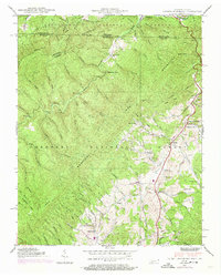
The Iron Mountains dominate this 1938 survey, where the border between Virginia and Tennessee cuts through the high ridges of the Jefferson National Forest and Cherokee National Forest. This pre-war landscape is defined by its small, scattered settlements and the early infrastructure of the Appalachian Trail. The presence of the CCC Camp Mc Arthur near Sutherland reflects the era's massive public works projects within the national forests. Local life centers on rural institutions like Pleasant Home Ch and several small schoolhouses, including Sutherland Sch and Wills Sch. The topography is exceptionally detailed, featuring landmarks like Backbone Rock and the drainage patterns of Beaverdam Creek, which dictated the location of early communities such as Laurel Bloomery and Shingletown.
Find a feature on this map
81 named features on this map. Tap any name to fly to it.
Don’t see what you’re looking for? This feature index may not catch every label — zoom into the map to look around manually.
Map Details
Editions of this 1938 Laurel Bloomery Map
5 editions found
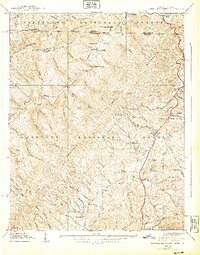
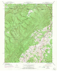
Other maps of this area

1891 · Abingdon
USGS Topo · 1:125,000

1893 · Cranberry
USGS Topo · 1:125,000

1894 · Abingdon
USGS Topo · 1:125,000

1895 · Cranberry
USGS Topo · 1:125,000

1899 · Cranberry
USGS Topo · 1:125,000

1902 · Cranberry
USGS Topo · 1:125,000

1909 · Abingdon
USGS Topo · 1:96,000

1911 · Abingdon
USGS Topo · 1:125,000

1935 · Konnarock
USGS Topo · 1:24,000

1935 · Abingdon
USGS Topo · 1:24,000