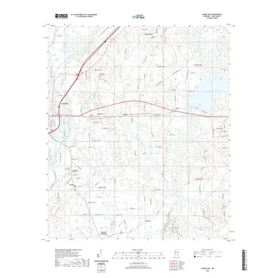
2020 Map of Laurel East
USGS Topo · Published 2020About this map
Laurel and its eastern surroundings in Jones County are defined by a complex network of waterways feeding into the Bogue Homo, including Dry Swamp Cr and Blacksnake Cr. This modern survey reveals the persistent rural footprint of communities like Eastview, Powers, and Antioch, where landscape features such as Old Meeting House Hill anchor the local geography. The map provides a detailed look at the interface between the urban edge of Laurel and the outlying country settlements connected by Old Hwy 84. Numerous burial grounds, including the Nora Davis Memorial Cem, Antioch Cem, and Providence Cem, offer valuable reference points for genealogists tracing family roots in this corner of Mississippi. The presence of Lake Bogue Homo in the northeast corner highlights the area's significant hydrography, which has historically shaped the road and settlement patterns of the region.
Find a feature on this map
127 named features on this map. Tap any name to fly to it.
Don’t see what you’re looking for? This feature index may not catch every label — zoom into the map to look around manually.
Map Details
Editions of this 2020 Laurel East Map
This is the sole edition of this map. No revisions or reprints were ever made.
Other maps of this area

1953 · Hattiesburg
USGS Topo · 1:250,000

1958 · Hattiesburg
USGS Topo · 1:250,000

1964 · Heidelberg SW
USGS Topo · 1:24,000

1964 · Moss
USGS Topo · 1:24,000

1964 · Sandersville
USGS Topo · 1:24,000

1964 · Laurel East
USGS Topo · 1:24,000

1964 · Laurel West
USGS Topo · 1:24,000

1964 · Ellisville
USGS Topo · 1:24,000

1964 · Myrick
USGS Topo · 1:24,000

1964 · Strengthford
USGS Topo · 1:24,000