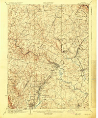
1926 Map of Laurel
USGS Topo · Published 1926About this map
The Patuxent River and its numerous branches, including the Middle Patuxent River and Little Patuxent River, anchor this detailed survey of central Maryland. The landscape is a complex network of early automotive and carriage routes like the Old Annapolis Road and the Baltimore and Washington Road, reflecting the region's position as a transit corridor between major cities. Specialized institutions of the era are prominently featured, such as the Christian Brothers College near the Pennsylvania RR and the House of Reformation near Jessup.
Find a feature on this map
87 named features on this map. Tap any name to fly to it.
Don’t see what you’re looking for? This feature index may not catch every label — zoom into the map to look around manually.
Map Details
Editions of this 1926 Laurel Map
4 editions found
Other maps of this area

1890 · Mt. Vernon
USGS Topo · 1:125,000

1891 · Mt. Vernon
USGS Topo · 1:125,000

1892 · Laurel
USGS Topo · 1:62,500

1892 · Ellicott
USGS Topo · 1:62,500

1892 · Owensville
USGS Topo · 1:62,500

1893 · Frederick
USGS Topo · 1:125,000

1894 · Ellicott
USGS Topo · 1:62,500

1894 · Laurel
USGS Topo · 1:62,500

1894 · Baltimore
USGS Topo · 1:62,500

1894 · Frederick
USGS Topo · 1:125,000