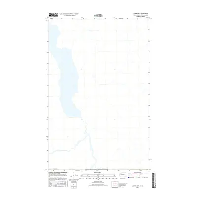
2017 Map of Laurier OE N
USGS Topo · Published 2017About this map
The international border between the United States of America and Canada defines the southern reach of this landscape. The terrain is characterized by a significant north-south water body and a complex network of drainage systems feeding into it from the surrounding elevations. This 2017 survey reflects the contemporary topography and hydrography of the region just north of the border, providing a clear record of the watershed and shoreline as they existed in the early 21st century. The map serves as a technical representation of the borderlands where the natural geography of British Columbia meets the international boundary.
Find a feature on this map
1 named feature on this map. Tap any name to fly to it.
Don’t see what you’re looking for? This feature index may not catch every label — zoom into the map to look around manually.
Map Details
Editions of this 2017 Laurier OE N Map
This is the sole edition of this map. No revisions or reprints were ever made.
Other maps of this area

1936 · Marcus
USGS Topo · 1:96,000

1942 · Marcus
USGS Topo · 1:125,000

1948 · Orient
USGS Topo · 1:62,500

1948 · Togo Mountain
USGS Topo · 1:62,500

1951 · Togo Mountain
USGS Topo · 1:62,500

1951 · Orient
USGS Topo · 1:62,500

1954 · Okanogan
USGS Topo · 1:250,000

1958 · Okanogan
USGS Topo · 1:250,000
1969 · Churchill Mtn
USGS Topo · 1:24,000
1969 · Laurier
USGS Topo · 1:24,000