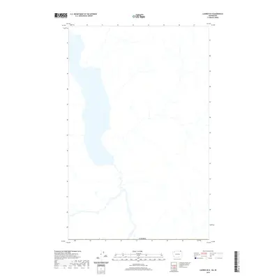
2020 Map of Laurier OE N
USGS Topo · Published 2020About this map
Hydrological patterns and international boundaries define this region of the northern frontier. Located just above the northern border of the United States, the geography is dominated by a significant elongated water body that stretches across the western half of the sheet. The southern edge of the map is marked by the international border with Canada, which follows a straight geometric line that bisects the natural drainage patterns of the region. A network of smaller tributaries and creeks feed into the primary lake and larger river system to the south, illustrating the complex watershed of the Kootenay Boundary area at the turn of the decade.
Find a feature on this map
1 named feature on this map. Tap any name to fly to it.
Don’t see what you’re looking for? This feature index may not catch every label — zoom into the map to look around manually.
Map Details
Editions of this 2020 Laurier OE N Map
This is the sole edition of this map. No revisions or reprints were ever made.
Other maps of this area

1936 · Marcus
USGS Topo · 1:96,000

1942 · Marcus
USGS Topo · 1:125,000

1948 · Orient
USGS Topo · 1:62,500

1948 · Togo Mountain
USGS Topo · 1:62,500

1951 · Togo Mountain
USGS Topo · 1:62,500

1951 · Orient
USGS Topo · 1:62,500

1954 · Okanogan
USGS Topo · 1:250,000

1958 · Okanogan
USGS Topo · 1:250,000
1969 · Churchill Mtn
USGS Topo · 1:24,000
1969 · Laurier
USGS Topo · 1:24,000