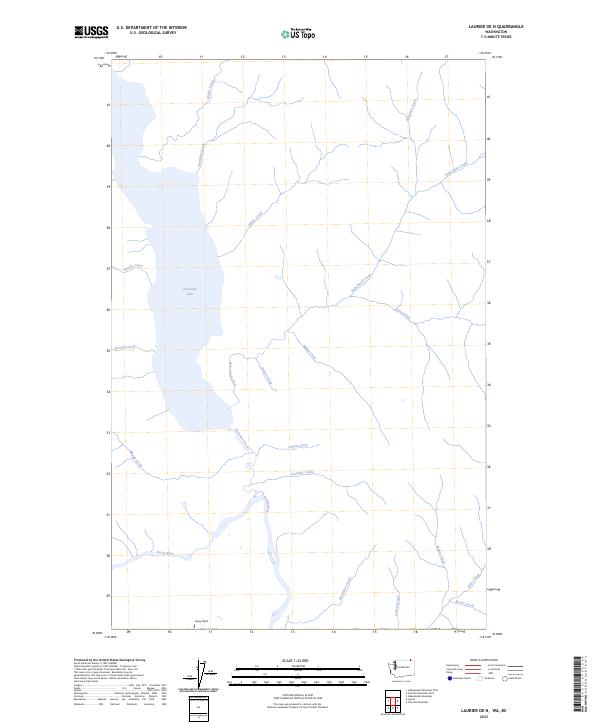
2023 Map of Laurier OE N
USGS Topo · Published 2023About this map
Christina Lake dominates the northern landscape of this Stevens County region, serving as the headwaters for Christina Creek as it flows south toward the winding Kettle River. The area is characterized by a dense network of watercourses named for local families and natural landmarks, including Sutherland Creek, Mastodon Creek, and Angelo Creek. Near the southern bend of the river lies Avey Field, a notable flat along the drainage system. The terrain is defined by the convergence of numerous smaller tributaries such as Maida Creek and Baker Creek, which carve through the high country before meeting the primary river valley. This map provides a detailed view of the remote drainage patterns and hydrological features that shaped the settlement and land use of the upper Kettle River basin into the early 21st century.
Find a feature on this map
23 named features on this map. Tap any name to fly to it.
Don’t see what you’re looking for? This feature index may not catch every label — zoom into the map to look around manually.
Map Details
Editions of this 2023 Laurier OE N Map
This is the sole edition of this map. No revisions or reprints were ever made.
Other maps of this area

1936 · Marcus
USGS Topo · 1:96,000

1942 · Marcus
USGS Topo · 1:125,000

1948 · Orient
USGS Topo · 1:62,500

1948 · Togo Mountain
USGS Topo · 1:62,500

1951 · Togo Mountain
USGS Topo · 1:62,500

1951 · Orient
USGS Topo · 1:62,500

1954 · Okanogan
USGS Topo · 1:250,000

1958 · Okanogan
USGS Topo · 1:250,000
1969 · Churchill Mtn
USGS Topo · 1:24,000
1969 · Laurier
USGS Topo · 1:24,000