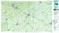
1983 Map of Laurinburg
USGS Topo · Published 1984About this map
The Sandhills Game Land and the sprawling Sand Hills dominate the northern landscape of this region, which straddles the border between the Carolinas. This 1980s-era documentation highlights a critical transportation corridor where the Seaboard Coast Line Railroad and Southern Railway intersect at Hamlet, a town whose identity was forged by these rail networks. The map tracks the winding course of the Lumber River and the Great Pee Dee River, showing how water dictated the placement of early settlements and industry near Blewett Falls Lake.
Find a feature on this map
132 named features on this map. Tap any name to fly to it.
Don’t see what you’re looking for? This feature index may not catch every label — zoom into the map to look around manually.
Map Details
Editions of this 1983 Laurinburg Map
2 editions found
Other maps of this area

1941 · Spartanburg
USGS Topo · 1:250,000

1942 · Troy
USGS Topo · 1:125,000

1942 · Rockingham
USGS Topo · 1:125,000

1943 · Pages Mill
USGS Topo · 1:62,500

1943 · Gum Swamp
USGS Topo · 1:62,500

1948 · Southern Pines
USGS Topo · 1:62,500

1948 · Fayetteville
USGS Topo · 1:62,500

1948 · Clifdale
USGS Topo · 1:62,500

1948 · Pinebluff
USGS Topo · 1:24,000

1948 · Nicholson Creek
USGS Topo · 1:24,000