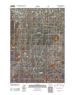
2011 Map of Lava Butte
USGS Topo · Published 2011About this map
Lava Butte and a series of volcanic landmarks dominate this high-desert landscape south of Bend. The topography is defined by distinct cinder cones and buttes, including Bessie Butte, Luna Butte, and Klawhop Butte, which rise above the surrounding volcanic plains. In the northwestern corner, the Deschutes River and Baker Lake provide a sharp contrast to the arid terrain, where the Deschutes River Woods area shows a densifying network of residential streets. The mapping of Blacks Ranch and the presence of roads like Scale House Rd and China Hat Rd reflect the transition from open range and forestry use to increasingly structured land management. This 2011 survey captures the area's mix of natural geologic features and the expanding infrastructure of Central Oregon.
Find a feature on this map
43 named features on this map. Tap any name to fly to it.
Don’t see what you’re looking for? This feature index may not catch every label — zoom into the map to look around manually.
Map Details
Editions of this 2011 Lava Butte Map
This is the sole edition of this map. No revisions or reprints were ever made.
Other maps of this area

1926 · Bend
USGS Topo · 1:125,000

1929 · Bend
USGS Topo · 1:125,000

1931 · Newberry Crater
USGS Topo · 1:125,000

1935 · Newberry Crater
USGS Topo · 1:125,000

1955 · Crescent
USGS Topo · 1:250,000

1955 · Bend
USGS Topo · 1:250,000

1957 · Crescent
USGS Topo · 1:250,000

1957 · Bend
USGS Topo · 1:250,000

1958 · Crescent
USGS Topo · 1:250,000

1958 · Bend
USGS Topo · 1:250,000