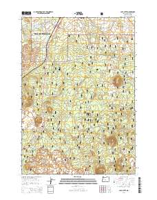
2014 Map of Lava Butte
USGS Topo · Published 2014About this map
Deschutes River Woods serves as a primary residential focal point on this volcanic landscape, where street names like Pumice Butte Rd, Cinder Butte Rd, and Crater Rd reflect the underlying geology of the High Desert. The prominent volcanic cinder cone of Lava Butte and the northwestern extent of the Newberry Volcano dominate the central terrain, bordered by the expansive reaches of the Deschutes National Forest. Development pushes southward from Bend along the Us-97 corridor, illustrating the transition from urban outskirts to protected forest lands. Traces of local infrastructure, such as Scale House Rd and Crawford RD, intersect with the natural features like Baker Lake, providing a clear record of how regional growth adapted to the unique basaltic topography of central Oregon in the early 21st century.
Find a feature on this map
63 named features on this map. Tap any name to fly to it.
Don’t see what you’re looking for? This feature index may not catch every label — zoom into the map to look around manually.
Map Details
Editions of this 2014 Lava Butte Map
This is the sole edition of this map. No revisions or reprints were ever made.
Other maps of this area

1926 · Bend
USGS Topo · 1:125,000

1929 · Bend
USGS Topo · 1:125,000

1931 · Newberry Crater
USGS Topo · 1:125,000

1935 · Newberry Crater
USGS Topo · 1:125,000

1955 · Crescent
USGS Topo · 1:250,000

1955 · Bend
USGS Topo · 1:250,000

1957 · Crescent
USGS Topo · 1:250,000

1957 · Bend
USGS Topo · 1:250,000

1958 · Crescent
USGS Topo · 1:250,000

1958 · Bend
USGS Topo · 1:250,000