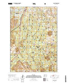
2020 Map of Lava Butte
USGS Topo · Published 2020About this map
Deschutes River Woods serves as a primary residential hub south of Bend in this 2020 landscape, where the high desert meets the volcanic slopes of the Deschutes National Forest. The map is dominated by a chain of volcanic features, including Bessie Butte, Huntington Butte, and the prominent Lava Butte Rim. This geological history is immortalized in the Trail of Molten Lands, which winds through the dark basaltic flows near the small settlements of Blackrock and Sun-Lava. While the northern section shows denser development with street names like Cheyenne Rd and Apache Rd, the southern reaches remain largely unpopulated, defined by the broader Newberry Volcano system and isolated peaks such as Luna Butte and Klawhop Butte.
Find a feature on this map
40 named features on this map. Tap any name to fly to it.
Don’t see what you’re looking for? This feature index may not catch every label — zoom into the map to look around manually.
Map Details
Editions of this 2020 Lava Butte Map
This is the sole edition of this map. No revisions or reprints were ever made.
Other maps of this area

1926 · Bend
USGS Topo · 1:125,000

1929 · Bend
USGS Topo · 1:125,000

1931 · Newberry Crater
USGS Topo · 1:125,000

1935 · Newberry Crater
USGS Topo · 1:125,000

1955 · Crescent
USGS Topo · 1:250,000

1955 · Bend
USGS Topo · 1:250,000

1957 · Crescent
USGS Topo · 1:250,000

1957 · Bend
USGS Topo · 1:250,000

1958 · Crescent
USGS Topo · 1:250,000

1958 · Bend
USGS Topo · 1:250,000