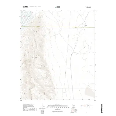
2020 Map of Lava
USGS Topo · Published 2020About this map
The Fra Cristobal Range dominates this high-desert landscape in Socorro and Sierra Counties, rising sharply from the eastern bank of the Rio Grande. This 2020 survey illustrates a sparsely settled region defined by its geological stature and infrastructure corridors. The settlement of Lava sits at the northern end of a valley floor, positioned along the historic transport line of the A T S F Railroad Rd. This rail line, alongside Powerline Rd, tracks through the lowlands between the mountains and the eastern plateau. The topography is defined by significant elevation changes, from the river valley through the steep slopes of Fra Cristobal Mtn and the recessed drainage of Silver Canyon, showing the geographic isolation and character of the New Mexico interior in the early twenty-first century.
Find a feature on this map
8 named features on this map. Tap any name to fly to it.
Don’t see what you’re looking for? This feature index may not catch every label — zoom into the map to look around manually.
Map Details
Editions of this 2020 Lava Map
This is the sole edition of this map. No revisions or reprints were ever made.
Other maps of this area

1916 · Salinas Peak
USGS Topo · 1:125,000

1948 · Val Verde
USGS Topo · 1:62,500

1948 · Malpais Well
USGS Topo · 1:62,500

1954 · Tularosa
USGS Topo · 1:250,000

1958 · Tularosa
USGS Topo · 1:250,000

1961 · Paraje Well
USGS Topo · 1:24,000

1961 · Black Bluffs
USGS Topo · 1:24,000

1961 · Black Hill
USGS Topo · 1:24,000

1961 · Crocker
USGS Topo · 1:24,000

1961 · Lava
USGS Topo · 1:24,000