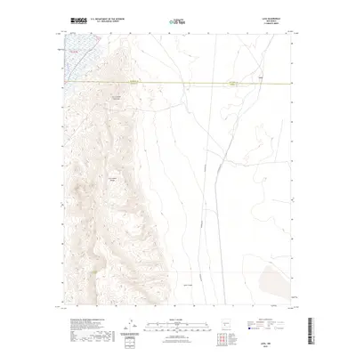
2023 Map of Lava
USGS Topo · Published 2023About this map
The Fra Cristobal Range dominates the western portion of this landscape, its steep topography rising sharply above the desert floor and creating the dramatic relief of Fra Cristobal Mountain. This 2023 edition highlights a section of New Mexico where the Rio Grande flows near the northwestern corner, just south of the border between Socorro Co and Sierra Co. The central and eastern plains are marked by significant utility and transportation corridors, including the long stretch of Powerline Rd and the A T S F Railroad Rd, which service the remote area near Lava. These features reflect a modern infrastructure grid superimposed on an arid landscape characterized by dry washes and deep incisions like Silver Canyon.
Find a feature on this map
8 named features on this map. Tap any name to fly to it.
Don’t see what you’re looking for? This feature index may not catch every label — zoom into the map to look around manually.
Map Details
Editions of this 2023 Lava Map
This is the sole edition of this map. No revisions or reprints were ever made.
Other maps of this area

1916 · Salinas Peak
USGS Topo · 1:125,000

1948 · Val Verde
USGS Topo · 1:62,500

1948 · Malpais Well
USGS Topo · 1:62,500

1954 · Tularosa
USGS Topo · 1:250,000

1958 · Tularosa
USGS Topo · 1:250,000

1961 · Paraje Well
USGS Topo · 1:24,000

1961 · Black Bluffs
USGS Topo · 1:24,000

1961 · Black Hill
USGS Topo · 1:24,000

1961 · Crocker
USGS Topo · 1:24,000

1961 · Lava
USGS Topo · 1:24,000