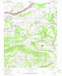
1947 Map of Lavaca
USGS Topo · Published 1972About this map
The Arkansas River serves as the dominant geographic feature of this area, marked by the extensive Ozark Reservoir and its meandering backwaters. In the late 1940s, the landscape south of the river shows a transition from the structured street grid of Lavaca to the sprawling hills of the Fort Smith Military Reservation, which occupies much of the southern quadrangle. This military land is interspersed with high points like Butlers Knob and Christmas Knob, while the northern industrial activity is evidenced by a cluster of strip mines near the Missouri Pacific railroad tracks.
Find a feature on this map
45 named features on this map. Tap any name to fly to it.
Don’t see what you’re looking for? This feature index may not catch every label — zoom into the map to look around manually.
Map Details
Editions of this 1947 Lavaca Map
2 editions found
Other maps of this area

1879 · Fort Smith
USGS Topo · 1:62,500

1887 · Van Buren
USGS Topo · 1:62,500

1887 · Greenwood
USGS Topo · 1:62,500

1890 · Fort Smith
USGS Topo · 1:125,000

1906 · Lavaca
USGS Topo · 1:62,500

1906 · Barber
USGS Topo · 1:62,500

1943 · Fort Smith
USGS Topo · 1:125,000

1946 · Fort Smith
USGS Topo · 1:250,000
1946 · Charleston
USGS Topo · 1:24,000

1947 · Lavaca
USGS Topo · 1:62,500