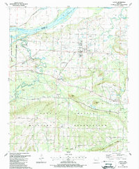
1987 Map of Lavaca
USGS Topo · Published 1988About this map
Lavaca serves as the primary hub of this Sebastian County landscape, situated just south of the Arkansas River and the expansive Ozark Lake. The late 1980s topography reveals a region defined by its transition from the river lowlands to the elevated terrain of Bloomer Ridge and Shale Ridge in the south. Much of the southern half of the quadrangle is occupied by the Fort Chaffee Military Reservation, where natural landmarks like Butlers Knob and Christmas Knob rise above the network of training grounds and secondary roads.
Find a feature on this map
59 named features on this map. Tap any name to fly to it.
Don’t see what you’re looking for? This feature index may not catch every label — zoom into the map to look around manually.
Map Details
Editions of this 1987 Lavaca Map
This is the sole edition of this map. No revisions or reprints were ever made.
Other maps of this area

1879 · Fort Smith
USGS Topo · 1:62,500

1887 · Van Buren
USGS Topo · 1:62,500

1887 · Greenwood
USGS Topo · 1:62,500

1890 · Fort Smith
USGS Topo · 1:125,000

1906 · Lavaca
USGS Topo · 1:62,500

1906 · Barber
USGS Topo · 1:62,500

1943 · Fort Smith
USGS Topo · 1:125,000

1946 · Fort Smith
USGS Topo · 1:250,000
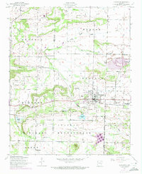
1946 · Charleston
USGS Topo · 1:24,000

1947 · Lavaca
USGS Topo · 1:62,500