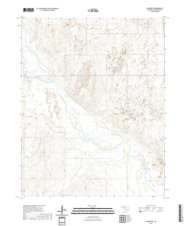
2022 Map of Laverne NE
USGS Topo · Published 2022About this map
The Beaver River meanders across this rural section of Harper County, carving a wide valley through the High Plains. This 2022 survey documents a landscape defined by its riparian corridors and an extensive network of range roads. The river’s course is joined by several significant tributaries, including Buffalo Cr in the northeast and Clear Cr to the south, which drain the surrounding prairie. While the terrain is largely open, the map reveals a systematic grid of section roads like N1790 Rd and E0250 Rd, which provide access to the remote ranchlands and agricultural tracts that characterize the Oklahoma Panhandle borderlands. The intricate contours along Spring Cr illustrate the subtle but complex drainage patterns that shape this cattle-country environment.
Find a feature on this map
26 named features on this map. Tap any name to fly to it.
Don’t see what you’re looking for? This feature index may not catch every label — zoom into the map to look around manually.
Map Details
Editions of this 2022 Laverne NE Map
This is the sole edition of this map. No revisions or reprints were ever made.
Other maps of this area

1955 · Woodward
USGS Topo · 1:250,000

1958 · Woodward
USGS Topo · 1:250,000

1970 · Laverne SW
USGS Topo · 1:24,000

1970 · Buffalo
USGS Topo · 1:24,000

1971 · Rosston SE
USGS Topo · 1:24,000

1971 · May East
USGS Topo · 1:24,000

1971 · Rosston
USGS Topo · 1:24,000

1971 · Fort Supply NW
USGS Topo · 1:24,000
1971 · Laverne
USGS Topo · 1:24,000

1971 · Laverne NE
USGS Topo · 1:24,000