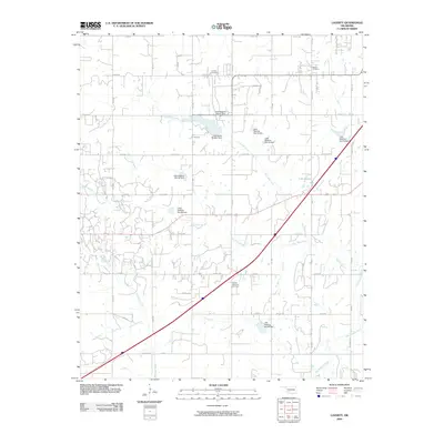
2009 Map of Laverty
USGS Topo · Published 2009About this map
Laverty Cemetery and Pioneer Cemetery anchor the northern reaches of this Oklahoma landscape, reflecting the long-standing agricultural roots of the area south of Chickasha. The terrain is defined by a sophisticated system of water management along the Little Washita River and its tributaries, characterized by a series of numbered flood control structures. Significant landmarks like the Lake Lewis Burtschi Dam and Little Washita Site 38 Dam manage the flow of East Bills Creek and West Bills Creek. This network of dams and reservoirs, including Lake Wanda, highlights the 21st-century conservation efforts to stabilize the drainage basins of McCarty Creek and Bills Creek. A strict grid of rural roads, such as Pioneer Rd and Wyatt Rd, provides access to these remote water works and ancestral burial grounds like Woods Memorial Cemetery.
Find a feature on this map
48 named features on this map. Tap any name to fly to it.
Don’t see what you’re looking for? This feature index may not catch every label — zoom into the map to look around manually.
Map Details
Editions of this 2009 Laverty Map
This is the sole edition of this map. No revisions or reprints were ever made.
Other maps of this area

1902 · Rush Springs
USGS Topo · 1:125,000

1904 · Chickasha
USGS Topo · 1:125,000

1945 · Anadarko
USGS Topo · 1:62,500

1949 · Cement
USGS Topo · 1:62,500

1949 · Rush Springs
USGS Topo · 1:62,500

1950 · Rush Springs
USGS Topo · 1:62,500

1954 · Oklahoma City
USGS Topo · 1:250,000

1955 · Lawton
USGS Topo · 1:250,000

1955 · Clinton
USGS Topo · 1:250,000

1956 · Laverty
USGS Topo · 1:24,000