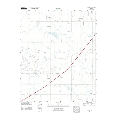
2012 Map of Laverty
USGS Topo · Published 2012About this map
Laverty stands as a primary focal point in this portion of Grady County, characterized by a structured grid of rural roads and a sophisticated network of water management reservoirs. The landscape is defined by the hydrologic management of the Little Washita River watershed, featuring numerous numbered sites such as Little Washita Site 41 Reservoir and Little Washita Site 36 Reservoir. Larger bodies of water like Lake Louis Burtschi and Lake Wanda provide significant landmarks within the rolling terrain. For genealogists, the map preserves the exact locations of several local burial grounds, including the Pioneer Cem and Woods Memorial Cem, which offer physical links to the early families of the area. The settlement of Farwell appears in the southeast corner, marking another point of historical interest along the section line roads like CO Road 1470.
Find a feature on this map
58 named features on this map. Tap any name to fly to it.
Don’t see what you’re looking for? This feature index may not catch every label — zoom into the map to look around manually.
Map Details
Editions of this 2012 Laverty Map
This is the sole edition of this map. No revisions or reprints were ever made.
Other maps of this area

1902 · Rush Springs
USGS Topo · 1:125,000

1904 · Chickasha
USGS Topo · 1:125,000

1945 · Anadarko
USGS Topo · 1:62,500

1949 · Cement
USGS Topo · 1:62,500

1949 · Rush Springs
USGS Topo · 1:62,500

1950 · Rush Springs
USGS Topo · 1:62,500

1954 · Oklahoma City
USGS Topo · 1:250,000

1955 · Lawton
USGS Topo · 1:250,000

1955 · Clinton
USGS Topo · 1:250,000

1956 · Laverty
USGS Topo · 1:24,000