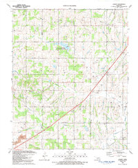
1991 Map of Laverty
USGS Topo · Published 1991About this map
Lake Louis Burtschi State Game Reservation serves as a central landmark in this portion of Oklahoma, where the landscape is defined by the intersection of water resources and energy infrastructure. The terrain is crisscrossed by an extensive network of oil and gas wells, reflecting the industrial character of the region during the late twentieth century. Along the eastern boundary, the H E Bailey Toll Road Turnpike cuts a diagonal path through the countryside, connecting the rural landscape to larger regional hubs.
Find a feature on this map
18 named features on this map. Tap any name to fly to it.
Don’t see what you’re looking for? This feature index may not catch every label — zoom into the map to look around manually.
Map Details
Editions of this 1991 Laverty Map
This is the sole edition of this map. No revisions or reprints were ever made.
Other maps of this area

1902 · Rush Springs
USGS Topo · 1:125,000

1904 · Chickasha
USGS Topo · 1:125,000

1945 · Anadarko
USGS Topo · 1:62,500

1949 · Cement
USGS Topo · 1:62,500

1949 · Rush Springs
USGS Topo · 1:62,500

1950 · Rush Springs
USGS Topo · 1:62,500

1954 · Oklahoma City
USGS Topo · 1:250,000

1955 · Lawton
USGS Topo · 1:250,000

1955 · Clinton
USGS Topo · 1:250,000

1956 · Laverty
USGS Topo · 1:24,000