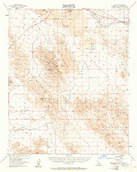
1955 Map of Lavic
USGS Topo · Published 1961About this map
The Atchison Topeka and Santa Fe railroad cuts across the northern reaches of this high desert landscape, connecting the small settlements of Lavic and Argos amid extensive lava beds. Mining activity is densely concentrated in the central mountains, with numerous operations such as the National Lead Mine, Imperial Lode Mine, and Mowry Mine dotting the slopes near Sunshine Peak. The presence of the Kenton Mill and various prospects suggests a period of active mineral extraction within the Bullion Mountains and Rodman Mountains.
Find a feature on this map
33 named features on this map. Tap any name to fly to it.
Don’t see what you’re looking for? This feature index may not catch every label — zoom into the map to look around manually.
Map Details
Editions of this 1955 Lavic Map
3 editions found

Other maps of this area

1901 · Southern California Sheet No. 1
USGS Topo · 1:250,000

1902 · San Gorgonio
USGS Topo · 1:125,000

1904 · Southern California Sheet No. 1
USGS Topo · 1:250,000

1953 · San Bernardino
USGS Topo · 1:250,000

1954 · Galway Lake
USGS Topo · 1:24,000

1954 · Hidalgo Mtn
USGS Topo · 1:24,000

1954 · Emerson Lake
USGS Topo · 1:24,000

1955 · Deadman Lake NW
USGS Topo · 1:24,000

1955 · Ludlow
USGS Topo · 1:24,000

1955 · Lavic SE
USGS Topo · 1:24,000