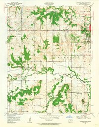
1950 Map of Lawrence West
USGS Topo · Published 1964About this map
The University of Kansas anchors the eastern edge of this landscape, representing the western expansion of Lawrence at the mid-century mark. Moving west from the campus, the terrain transitions into a series of rural townships, including Kanwaka and Wakarusa, where the Wakarusa River carves a winding path through the valley. This 1950 field-checked map illustrates a well-developed network of country schools, such as Kanwaka Sch, Sigel Sch, and Brackett Sch, which served the farming communities before widespread consolidation. The presence of Pioneer Cem and Richland Cem provides valuable landmarks for those tracing early settler roots in Douglas County. Along the southern reaches, Washington Creek and Yankee Tank Creek feed the main river, while prominent elevations like Shank Hill rise above the agricultural flats. Local industry is visible in several Quarry sites scattered near the ridgelines, marking the extraction of the area's limestone resources.
Find a feature on this map
24 named features on this map. Tap any name to fly to it.
Don’t see what you’re looking for? This feature index may not catch every label — zoom into the map to look around manually.
Map Details
Editions of this 1950 Lawrence West Map
4 editions found
Other maps of this area

1885 · Lawrence
USGS Topo · 1:125,000

1886 · Oskaloosa
USGS Topo · 1:125,000

1888 · Oskaloosa
USGS Topo · 1:125,000

1889 · Lawrence
USGS Topo · 1:125,000

1894 · Oskaloosa
USGS Topo · 1:125,000

1947 · Lawrence
USGS Topo · 1:250,000

1949 · Williamstown
USGS Topo · 1:24,000

1949 · Perry
USGS Topo · 1:24,000

1950 · Perry
USGS Topo · 1:24,000

1950 · Kansas City
USGS Topo · 1:250,000