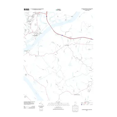
2013 Map of Lawrenceburg
USGS Topo · Published 2013About this map
The Ohio River carves a deep valley through the center of this tri-state region, separating the clustered street grids of Lawrenceburg and Greendale in Indiana from the rolling terrain of Boone County, Kentucky. This landscape is defined by the convergence of major waterways, including the Great Miami River and the sweeping bend near Petersburg. The map reveals a transition from the industrial and residential corridors of Ludlow Hill and Hardinsburg to the more dispersed rural communities like Idlewild and Commissary Corner. Genealogists and local historians can trace legacy landmarks such as Oldtown and the prominent heights of Fort Hill. Small aviation history is preserved at Sunrise Acres Airport, while the intricate network of local drainages—including Woolper Cr and Double Lick Cr—illustrates the natural drainage patterns that have dictated local land use for generations.
Find a feature on this map
127 named features on this map. Tap any name to fly to it.
Don’t see what you’re looking for? This feature index may not catch every label — zoom into the map to look around manually.
Map Details
Editions of this 2013 Lawrenceburg Map
This is the sole edition of this map. No revisions or reprints were ever made.
Other maps of this area

1914 · West Cincinnati
USGS Topo · 1:62,500

1915 · Lawrenceburg
USGS Topo · 1:48,000

1928 · Lawrenceburg
USGS Topo · 1:62,500

1932 · Lawrenceburg
USGS Topo · 1:62,500

1943 · Aberdeen
USGS Topo · 1:24,000

1943 · Aurora
USGS Topo · 1:24,000

1943 · Rising Sun
USGS Topo · 1:24,000

1943 · Hooven
USGS Topo · 1:24,000

1943 · Guilford
USGS Topo · 1:24,000

1943 · Lawrenceburg
USGS Topo · 1:24,000