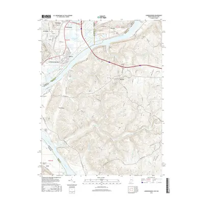
2016 Map of Lawrenceburg
USGS Topo · Published 2016About this map
Lawrenceburg and the surrounding tri-state river valley where Indiana, Kentucky, and Ohio converge are captured in this modern survey. The Ohio River remains the central artery of the region, flanked by settlements like Oldtown and Petersburg. The landscape is characterized by its complex topography, where the high ground of Ludlow Hill and Coll Hill overlooks the winding paths of Woolper Creek and Tanners Creek. Historical burial grounds are scattered across the terrain, including the Dinsmore Cem and Tousey Cem, providing valuable touchstones for genealogical research in Boone and Dearborn counties.
Find a feature on this map
136 named features on this map. Tap any name to fly to it.
Don’t see what you’re looking for? This feature index may not catch every label — zoom into the map to look around manually.
Map Details
Editions of this 2016 Lawrenceburg Map
This is the sole edition of this map. No revisions or reprints were ever made.
Other maps of this area

1914 · West Cincinnati
USGS Topo · 1:62,500

1915 · Lawrenceburg
USGS Topo · 1:48,000

1928 · Lawrenceburg
USGS Topo · 1:62,500

1932 · Lawrenceburg
USGS Topo · 1:62,500

1943 · Aberdeen
USGS Topo · 1:24,000

1943 · Aurora
USGS Topo · 1:24,000

1943 · Rising Sun
USGS Topo · 1:24,000

1943 · Hooven
USGS Topo · 1:24,000

1943 · Guilford
USGS Topo · 1:24,000

1943 · Lawrenceburg
USGS Topo · 1:24,000