
1932 Map of Lawrenceburg
USGS Topo · Published 1932About this map
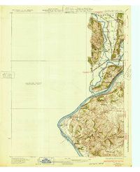
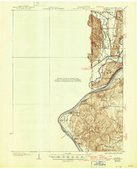
Whitewater River and the Miami River converge here just before joining the massive bend of the Ohio River at the borders of Indiana, Ohio, and Kentucky. This early 1930s survey illustrates a landscape defined by its waterways and transport corridors, featuring the prominent Lost Bridge and a Suspension Bridge spanning the rivers. The rail infrastructure of the C C C and St L RR meets at Valley Junction, while the C & W Electric Road follows the northern banks, linking settlements like Elizabethtown and Cleves. Local life is anchored by family-named landmarks and rural institutions such as Eighteenmile House, Bullittsville Ch, and Mt Nebo School. The topography reveals the transition from the river plains to the higher ground of Fort Hill and Fort Gass, providing a window into the pre-war rural development of the tri-state area.
Find a feature on this map
52 named features on this map. Tap any name to fly to it.
Don’t see what you’re looking for? This feature index may not catch every label — zoom into the map to look around manually.
Map Details
Editions of this 1932 Lawrenceburg Map
3 editions found
Other maps of this area

1914 · West Cincinnati
USGS Topo · 1:62,500

1915 · Lawrenceburg
USGS Topo · 1:48,000

1915 · Harrison
USGS Topo · 1:48,000

1915 · Hamilton
USGS Topo · 1:62,500

1917 · Hamilton
USGS Topo · 1:62,500

1928 · Lawrenceburg
USGS Topo · 1:62,500

1943 · Aberdeen
USGS Topo · 1:24,000

1943 · Aurora
USGS Topo · 1:24,000

1943 · Rising Sun
USGS Topo · 1:24,000

1943 · Hooven
USGS Topo · 1:24,000
Featured Places
- Burlington, KY
- Harrison, Harrison Township
- Lawrenceburg, Lawrenceburg Township
- Greendale, Lawrenceburg Township
- Aurora, Center Township