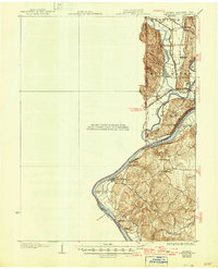
1932 Map of Lawrenceburg
USGS Topo · Published 1946About this map
The Ohio River and Miami River converge in a complex hydrographic landscape at the borders of Indiana, Ohio, and Kentucky. This area, surveyed by R.L. Harrison and the U.S. Army Corps of Engineers, shows a dense concentration of early 20th-century transport infrastructure. Heavy rail corridors like the B and O RR and the C C C and St L RR intersect at Valley Junction, while the presence of the Electric RR and the Cincinnati And Harrison Road highlights the transition from horse-drawn routes to modern transit.
Find a feature on this map
45 named features on this map. Tap any name to fly to it.
Don’t see what you’re looking for? This feature index may not catch every label — zoom into the map to look around manually.
Map Details
Editions of this 1932 Lawrenceburg Map
3 editions found
Other maps of this area

1914 · West Cincinnati
USGS Topo · 1:62,500

1915 · Lawrenceburg
USGS Topo · 1:48,000

1915 · Harrison
USGS Topo · 1:48,000

1915 · Hamilton
USGS Topo · 1:62,500

1917 · Hamilton
USGS Topo · 1:62,500

1928 · Lawrenceburg
USGS Topo · 1:62,500

1932 · Lawrenceburg
USGS Topo · 1:62,500

1943 · Aberdeen
USGS Topo · 1:24,000

1943 · Aurora
USGS Topo · 1:24,000

1943 · Rising Sun
USGS Topo · 1:24,000