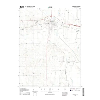
2015 Map of Lawrenceville
USGS Topo · Published 2015About this map
The Embarras River curves through the eastern portion of this Lawrence County landscape, defining the agricultural and drainage patterns of the region. The city of Lawrenceville serves as the central hub, where a dense grid of streets like Jefferson St and Washington Ave meets major thoroughfares. To the west, the map reaches toward the edge of Bridgeport, while smaller communities such as Billett and Jackson are situated along the rail and road corridors that cross the prairie.
Find a feature on this map
38 named features on this map. Tap any name to fly to it.
Don’t see what you’re looking for? This feature index may not catch every label — zoom into the map to look around manually.
Map Details
Editions of this 2015 Lawrenceville Map
This is the sole edition of this map. No revisions or reprints were ever made.
Other maps of this area

1910 · Hardinville
USGS Topo · 1:62,500

1911 · Sumner
USGS Topo · 1:62,500

1913 · Sumner
USGS Topo · 1:62,500

1915 · Vincennes
USGS Topo · 1:62,500

1917 · Birds
USGS Topo · 1:62,500

1942 · Birds
USGS Topo · 1:62,500

1944 · Vincennes
USGS Topo · 1:62,500

1956 · Vincennes
USGS Topo · 1:250,000

1957 · Vincennes
USGS Topo · 1:250,000

1958 · Vincennes
USGS Topo · 1:250,000