
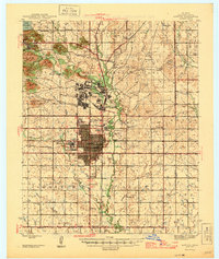
1946 Map of Lawton
USGS Topo · Published 1946About this map
Fort Sill and the city of Lawton anchor this mid-century landscape, illustrating the deep connection between the military post and the urban growth of Comanche County. The survey captures the transition from the rugged hills around Medicine Park and Lake Lawtonka in the northwest to the organized grid of the city. Significant institutional footprints are visible, including the Cameron State Agricultural College and the Fort Sill Indian School Reservation.
Find a feature on this map
64 named features on this map. Tap any name to fly to it.
Don’t see what you’re looking for? This feature index may not catch every label — zoom into the map to look around manually.
Map Details
Editions of this 1946 Lawton Map
2 editions found
Other maps of this area

1937 · Cache
USGS Topo · 1:48,000

1942 · Cache
USGS Topo · 1:62,500

1949 · Mount Scott
USGS Topo · 1:24,000

1949 · Arbuckle Hill
USGS Topo · 1:24,000

1949 · Cement
USGS Topo · 1:62,500

1949 · Elgin
USGS Topo · 1:24,000

1949 · Fort Sill
USGS Topo · 1:24,000

1949 · Nellie
USGS Topo · 1:62,500

1950 · Saddle Mountain
USGS Topo · 1:62,500

1955 · Lawton
USGS Topo · 1:250,000
Featured Places
- Lawton, OK
- Medicine Park, OK
- white Wolf Manor, Lawton
- Artillery Village Greenspace, Lawton
- 10 Mile Crossing, OK