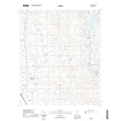
2020 Map of Lay Dam
USGS Topo · Published 2020About this map
Lay Dam anchors the eastern edge of this landscape, where the Coosa River transitions into Lay Lake along the border of Chilton and Coosa counties. The surrounding terrain is a complex network of ridges and drainages, marked by the prominent Chandler Mountain and the distinct pass known as Gap of the Mountain. This topography has historically shaped the local settlement patterns, with small communities like Jumbo and the northern outskirts of Clanton connected by a web of county roads and Alabama Highway 145.
Find a feature on this map
110 named features on this map. Tap any name to fly to it.
Don’t see what you’re looking for? This feature index may not catch every label — zoom into the map to look around manually.
Map Details
Editions of this 2020 Lay Dam Map
This is the sole edition of this map. No revisions or reprints were ever made.
Other maps of this area

1890 · Bessemer
USGS Topo · 1:125,000

1890 · Talladega
USGS Topo · 1:125,000

1891 · Clanton
USGS Topo · 1:125,000

1892 · Talladega
USGS Topo · 1:125,000

1892 · Bessemer
USGS Topo · 1:125,000

1901 · Wetumpka
USGS Topo · 1:125,000

1903 · Wetumpka
USGS Topo · 1:125,000

1909 · Columbiana
USGS Topo · 1:62,500

1911 · Columbiana
USGS Topo · 1:62,500

1915 · Gantts Quarry
USGS Topo · 1:48,000