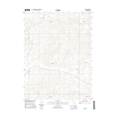
2016 Map of Lay SE
USGS Topo · Published 2016About this map
Lay Cr winds through the northern portion of this high-desert terrain, cutting through a landscape defined by significant erosional features. The drainage systems of Bord Gulch and Big Gulch dominate the topography, providing a detailed look at the water-carved geography of Moffat County. In the southern half of the quadrangle, W Victory Way serves as a primary east-west corridor, mirroring the path of the North Fork Big Gulch. This road network is supported by local connectors such as Co Rd 17 and Co Rd 15, which link the various gulches and plateaus. The map illustrates a transitional rural landscape where traditional ranching roads like Lay Creek Dr interface with modern regional infrastructure.
Find a feature on this map
15 named features on this map. Tap any name to fly to it.
Don’t see what you’re looking for? This feature index may not catch every label — zoom into the map to look around manually.
Map Details
Editions of this 2016 Lay SE Map
This is the sole edition of this map. No revisions or reprints were ever made.
Other maps of this area

1910 · Danforth Hills
USGS Topo · 1:125,000

1912 · Axial
USGS Topo · 1:62,500

1914 · Axial
USGS Topo · 1:62,500

1915 · Monument Butte
USGS Topo · 1:62,500

1916 · Craig
USGS Topo · 1:125,000

1954 · Craig
USGS Topo · 1:250,000

1957 · Craig
USGS Topo · 1:250,000

1958 · Craig
USGS Topo · 1:250,000

1960 · Craig
USGS Topo · 1:250,000

1962 · Craig
USGS Topo · 1:250,000