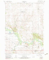
1960 Map of Le Grand
USGS Topo · Published 1983About this map
Iowa River meanders through the heart of this landscape, defining the industrial and agricultural rhythm of the area between Marshalltown and the Marshall-Tama county line. The river's influence is evident in the cluster of heavy industry and utilities along its banks, including a powerplant, a substation, and a fish hatchery. The transportation network is dominated by the Chicago Great Western and the Chicago and North Western railroads, which intersect the terrain and connect the primary settlements of Le Grand and Green Mountain. Extensive extraction sites like quarries, a gravel pit, and a sandpit underscore the region's reliance on geological resources. For local historians, the placement of rural landmarks such as Pleasant Hill Cem and the Iowa River Ch provides a window into the community's mid-century distribution and social foundations.
Find a feature on this map
31 named features on this map. Tap any name to fly to it.
Don’t see what you’re looking for? This feature index may not catch every label — zoom into the map to look around manually.
Map Details
Editions of this 1960 Le Grand Map
2 editions found
Other maps of this area

1954 · Waterloo
USGS Topo · 1:250,000

1954 · Des Moines
USGS Topo · 1:250,000

1955 · Waterloo
USGS Topo · 1:250,000

1956 · Des Moines
USGS Topo · 1:250,000

1957 · Des Moines
USGS Topo · 1:250,000

1960 · Marshalltown
USGS Topo · 1:24,000

1960 · Marshalltown
USGS Topo · 1:62,500

1960 · Le Grand
USGS Topo · 1:24,000

1960 · Conrad West
USGS Topo · 1:24,000

1960 · Conrad East
USGS Topo · 1:24,000