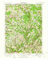
1943 Map of Le Raysville
USGS Topo · Published 1965About this map
Le Raysville and the high dairy country of the northern Tier are captured in this 1943 survey, showing a landscape defined by small hamlets and the headwaters of Wyalusing Creek. This area of the Bradford Co Susquehanna Co border is dotted with rural institutions that served farming families, from the North Warren Ch near the New York state line to the St Patricks Ch further south. The settlement pattern follows the drainages of Apalachin Creek and the Middle Branch, with many small crossroads such as Stone House Corner and Parks Crossroad acting as local anchors.
Find a feature on this map
95 named features on this map. Tap any name to fly to it.
Don’t see what you’re looking for? This feature index may not catch every label — zoom into the map to look around manually.
Map Details
Editions of this 1943 Le Raysville Map
2 editions found

Other maps of this area

1901 · Apalachin
USGS Topo · 1:62,500

1903 · Owego
USGS Topo · 1:62,500

1904 · Binghamton
USGS Topo · 1:62,500

1904 · Apalachin
USGS Topo · 1:62,500

1906 · Catatonk
USGS Topo · 1:125,000

1923 · Towanda
USGS Topo · 1:62,500

1926 · Towanda
USGS Topo · 1:62,500

1935 · Binghamton West
USGS Topo · 1:24,000

1942 · Binghamton West
USGS Topo · 1:31,680

1943 · Towanda
USGS Topo · 1:62,500