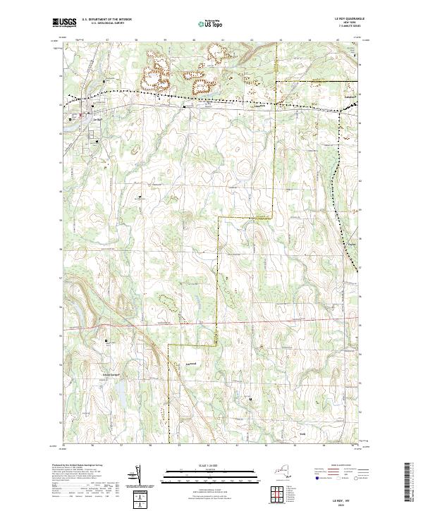
2023 Map of Le Roy
USGS Topo · Published 2023About this map
Le Roy serves as the primary hub on this map, situated where Oatka Creek winds through the landscape. The town is marked by a concentration of local history, including several burial grounds such as Machpelah Cem and Saint Marks Cem. The geography is defined by its position at the intersection of Genesee, Monroe, and Livingston counties, with small settlements like Limerock and Caledonia dotting the eastern edges. Modern infrastructure like the Le Roy Airport sits alongside more established rural crossroads such as Linwood and Union Corners. Further south, the landscape opens into agricultural terrain drained by Browns Creek and Mud Creek, maintaining a pattern of settlement that follows early transit corridors like E Main St and LeRoy-Caledonia Rd.
Find a feature on this map
86 named features on this map. Tap any name to fly to it.
Don’t see what you’re looking for? This feature index may not catch every label — zoom into the map to look around manually.
Map Details
Editions of this 2023 Le Roy Map
This is the sole edition of this map. No revisions or reprints were ever made.
Other maps of this area

1897 · Albion
USGS Topo · 1:62,500

1899 · Brockport
USGS Topo · 1:62,500

1904 · Batavia
USGS Topo · 1:62,500

1904 · Caledonia
USGS Topo · 1:62,500

1934 · Clifton
USGS Topo · 1:24,000

1935 · Churchville
USGS Topo · 1:24,000
1944 · Geneseo
USGS Topo · 1:31,680

1944 · Churchville
USGS Topo · 1:31,680

1944 · Byron
USGS Topo · 1:31,680

1944 · Stafford
USGS Topo · 1:31,680