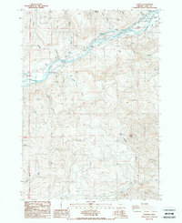
1988 Map of Leaburg
USGS Topo · Published 1988About this map
The Mc Kenzie River dictates the movement and industry of this mid-1980s landscape, flanked by the communities of Leaburg and Deerhorn. This corridor serves as a vital artery for both energy and conservation, evidenced by the Leaburg Power Plant and the nearby McKenzie Salmon Hatchery. An intricate system of levees, including the Electric Board Levee, manages the river's flow through the valley, while landmarks like Greenwood Landing and Leaburg Landing suggest a long-standing relationship with river-based transit and recreation.
Find a feature on this map
37 named features on this map. Tap any name to fly to it.
Don’t see what you’re looking for? This feature index may not catch every label — zoom into the map to look around manually.
Map Details
Editions of this 1988 Leaburg Map
This is the sole edition of this map. No revisions or reprints were ever made.
Other maps of this area

1935 · Lowell
USGS Topo · 1:96,000

1942 · Lowell
USGS Topo · 1:125,000

1950 · Marcola
USGS Topo · 1:62,500

1951 · Leaburg
USGS Topo · 1:62,500

1952 · Marcola
USGS Topo · 1:62,500

1953 · Salem
USGS Topo · 1:250,000

1954 · Salem
USGS Topo · 1:250,000

1955 · Hardesty Mtn
USGS Topo · 1:62,500

1955 · Lowell
USGS Topo · 1:62,500

1958 · Roseburg
USGS Topo · 1:250,000