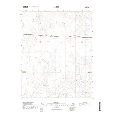
2018 Map of Leach
USGS Topo · Published 2018About this map
The border of Delaware Co and Cherokee Co divides this rural landscape in northeastern Oklahoma, where the settlement of Leach serves as a primary local landmark. To the south, Rocky Ford sits near the winding course of Double Spring Cr, part of a complex drainage network that includes Saline Cr and Spring Cr. This area is characterized by its creek valleys and a dense grid of local roads, such as E0550 Rd and N4550 Rd, that connect dispersed homesteads. For those researching family history in this part of the Ozark plateau, the map identifies specific local burial grounds including Batt Cem and Elm Cem, providing essential points of reference for genealogical studies in the region's smaller communities.
Find a feature on this map
60 named features on this map. Tap any name to fly to it.
Don’t see what you’re looking for? This feature index may not catch every label — zoom into the map to look around manually.
Map Details
Editions of this 2018 Leach Map
This is the sole edition of this map. No revisions or reprints were ever made.
Other maps of this area

1896 · Pryor
USGS Topo · 1:125,000

1899 · Siloam Springs
USGS Topo · 1:125,000

1901 · Pryor
USGS Topo · 1:125,000

1903 · Siloam Springs
USGS Topo · 1:125,000

1904 · Siloam Springs
USGS Topo · 1:125,000

1954 · Tulsa
USGS Topo · 1:250,000

1958 · Tulsa
USGS Topo · 1:250,000

1963 · Tulsa
USGS Topo · 1:250,000

1971 · Kenwood
USGS Topo · 1:24,000

1971 · Jay SE
USGS Topo · 1:24,000