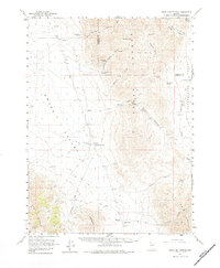
1961 Map of Leach Hot Springs
USGS Topo · Published 1984About this map
Leach Hot Springs serves as a geothermal focal point in this high-desert landscape, where the basin of Grass Valley meets the rising terrain of the Sonoma Range. The map reveals a post-war ranching and mining economy defined by isolated outposts like Clear Creek Ranch and Hot Springs Ranch. Water management is critical for survival in this arid environment, evidenced by named features such as Lower Grand Trunk Reservoir and a network of desert springs including Grand Trunk Spring and Manganese Spring.
Find a feature on this map
41 named features on this map. Tap any name to fly to it.
Don’t see what you’re looking for? This feature index may not catch every label — zoom into the map to look around manually.
Map Details
Editions of this 1961 Leach Hot Springs Map
3 editions found
Other maps of this area

1932 · Sonoma Range
USGS Topo · 1:250,000

1939 · Sonoma Range
USGS Topo · 1:250,000

1955 · Winnemucca
USGS Topo · 1:250,000

1958 · Winnemucca
USGS Topo · 1:250,000

1958 · Winnemucca
USGS Topo · 1:62,500

1958 · Rose Creek
USGS Topo · 1:62,500
1961 · Kyle Hot Springs
USGS Topo · 1:62,500

1961 · Mt. Tobin
USGS Topo · 1:62,500

1961 · Leach Hot Springs
USGS Topo · 1:62,500

1961 · Dun Glen
USGS Topo · 1:62,500