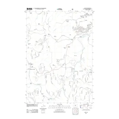
2012 Map of Lead
USGS Topo · Published 2012About this map
The mining history of Lawrence County is etched into the landscape surrounding Terraville and the slopes of Terry Peak. This 2012 survey shows the modern footprint of historical mining settlements like Trojan, Terry, and Gayville, where steep gulches and mountain ridges have long dictated the path of human infrastructure. Roads such as Wharf Mine Rd and Cutting Mine Rd snake through the terrain, connecting high-altitude sites like Bald Mountain and Green Mountain to the narrow valleys below. Cultural sites such as the West Lead Cem and Englewood Cem offer essential points of interest for genealogists tracing families from the Black Hills gold rush era. To the south, the landscape shifts toward the recreational and water-rich corridors of Spearfish Cr and the Hanna Campground, illustrating how this mountain region serves both industrial and leisure pursuits across its many draws and flats.
Find a feature on this map
100 named features on this map. Tap any name to fly to it.
Don’t see what you’re looking for? This feature index may not catch every label — zoom into the map to look around manually.
Map Details
Editions of this 2012 Lead Map
This is the sole edition of this map. No revisions or reprints were ever made.
Other maps of this area

1894 · Deadwood
USGS Topo · 1:125,000

1899 · Sturgis
USGS Topo · 1:62,500

1900 · Spearfish
USGS Topo · 1:62,500

1901 · Deadwood
USGS Topo · 1:125,000

1915 · Spearfish
USGS Topo · 1:62,500

1915 · Sturgis
USGS Topo · 1:62,500

1916 · Deadwood
USGS Topo · 1:125,000

1953 · Rapid City
USGS Topo · 1:250,000
1956 · Crooks Tower
USGS Topo · 1:24,000
1956 · Nahant
USGS Topo · 1:24,000