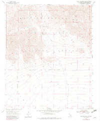
1955 Map of Lead Mountain SW
USGS Topo · Published 1982About this map
The Bullion Mountains dominate this high desert landscape within San Bernardino County, where topographical contours reveal a network of ridgelines and steep passes. This mid-century survey illustrates the intense military utilization of the California desert, clearly demarcating the Marine Corps Training Center and the Naval Reservation Boundary as they intersect the natural terrain. The absence of permanent civilian settlements underscores the region's transition into a dedicated federal training ground during the Cold War era.
Find a feature on this map
6 named features on this map. Tap any name to fly to it.
Don’t see what you’re looking for? This feature index may not catch every label — zoom into the map to look around manually.
Map Details
Editions of this 1955 Lead Mountain SW Map
3 editions found
Other maps of this area

1942 · Amboy
USGS Topo · 1:250,000

1943 · Amboy
USGS Topo · 1:250,000

1953 · San Bernardino
USGS Topo · 1:250,000

1954 · Needles
USGS Topo · 1:250,000

1954 · Valley Mtn
USGS Topo · 1:24,000

1955 · Lead Mountain
USGS Topo · 1:24,000

1955 · Deadman Lake SE
USGS Topo · 1:24,000

1955 · Lead Mtn. NE
USGS Topo · 1:24,000

1955 · Deadman Lake NE
USGS Topo · 1:24,000

1955 · Lead Mountain SW
USGS Topo · 1:24,000