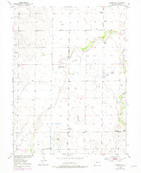
1952 Map of Leader SW
USGS Topo · Published 1979About this map
West Bijou Creek and East Bijou Creek dominate this 1952 topographic study of the Colorado plains, where water management defines the landscape. The infrastructure of the high plains is evident in the Hopewell Ditch and an Abandoned Reservoir, reflecting the constant struggle for irrigation in an arid region. Ranching life is documented through named family operations such as Munson Ranch, Staple D Ranch, Sherman Ranch, and Bigger Ranch, which are scattered across the vast terrain along with numerous Windmill sites.
Find a feature on this map
19 named features on this map. Tap any name to fly to it.
Don’t see what you’re looking for? This feature index may not catch every label — zoom into the map to look around manually.
Map Details
Editions of this 1952 Leader SW Map
4 editions found
Other maps of this area

1950 · Roper School
USGS Topo · 1:24,000

1951 · Roper School
USGS Topo · 1:24,000

1951 · Living Springs
USGS Topo · 1:24,000

1951 · Leader NW
USGS Topo · 1:24,000

1951 · Leader SE
USGS Topo · 1:24,000

1951 · Leader
USGS Topo · 1:24,000

1952 · Leader SW
USGS Topo · 1:24,000

1953 · Denver
USGS Topo · 1:250,000

1955 · Strasburg
USGS Topo · 1:24,000

1956 · Peoria
USGS Topo · 1:24,000