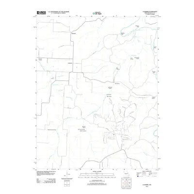
2012 Map of Leadmine
USGS Topo · Published 2012About this map
The Niangua River and its various tributaries carve a complex landscape of bluffs and hollows in this 2012 survey of Dallas County. The topography is defined by significant elevations like Webster Bluff and Turner Bluff, which rise above the river valley. Evidence of local industry and early settlement is preserved in place names such as Leadmine, Smelter Hollow, and Sawmill Hollow, reflecting the historical resource extraction and processing that once occurred here. Water sources were clearly vital to the area’s development, noted by the presence of Webster Spring and King Spring. The small settlement of Westfield sits in the northern portion of the map, while the Kirk Cemetery provides a specific point of interest for genealogists tracking local families near Lane Branch. The naming of Herrick Ford suggests a longstanding river crossing point predating modern infrastructure.
Find a feature on this map
65 named features on this map. Tap any name to fly to it.
Don’t see what you’re looking for? This feature index may not catch every label — zoom into the map to look around manually.
Map Details
Editions of this 2012 Leadmine Map
This is the sole edition of this map. No revisions or reprints were ever made.
Other maps of this area

1884 · Bolivar
USGS Topo · 1:125,000

1892 · Bolivar
USGS Topo · 1:125,000

1934 · Macks Creek
USGS Topo · 1:48,000

1939 · Macks Creek
USGS Topo · 1:62,500

1939 · Long Lane
USGS Topo · 1:62,500

1942 · Long Lane
USGS Topo · 1:62,500

1954 · Springfield
USGS Topo · 1:250,000

1958 · Springfield
USGS Topo · 1:250,000

1959 · Springfield
USGS Topo · 1:250,000
1960 · Branch
USGS Topo · 1:24,000