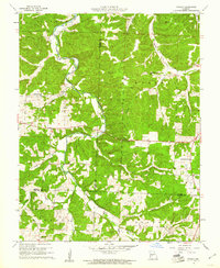
1960 Map of Branch
USGS Topo · Published 1961About this map
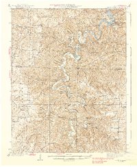
The Little Niangua River winds through the borderlands of Camden, Hickory, and Dallas counties, anchoring a rural Missouri landscape defined by dispersed homesteads and small community centers. This 1960 survey highlights the settlement at Branch, where the Branch Lookout Tower overlooks a terrain crisscrossed by numerous seasonal waterways such as Long Branch and Pippin Branch. The map reveals a high density of country churches that served as social anchors for the surrounding farms, including Little Niangua Ch, Hickory Grove Ch, and the Assembly of God Ch.
Find a feature on this map
31 named features on this map. Tap any name to fly to it.
Don’t see what you’re looking for? This feature index may not catch every label — zoom into the map to look around manually.
Map Details
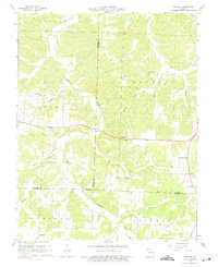
Editions of this 1960 Branch Map
2 editions found
Other maps of this area

1884 · Bolivar
USGS Topo · 1:125,000

1887 · Warsaw
USGS Topo · 1:125,000

1888 · Versailles
USGS Topo · 1:125,000

1892 · Bolivar
USGS Topo · 1:125,000

1893 · Versailles
USGS Topo · 1:125,000

1894 · Warsaw
USGS Topo · 1:125,000
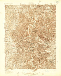
1934 · Macks Creek
USGS Topo · 1:48,000
1935 · Barnumton
USGS Topo · 1:24,000
1939 · Macks Creek
USGS Topo · 1:62,500

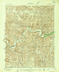
1947 · Jefferson City
USGS Topo · 1:250,000