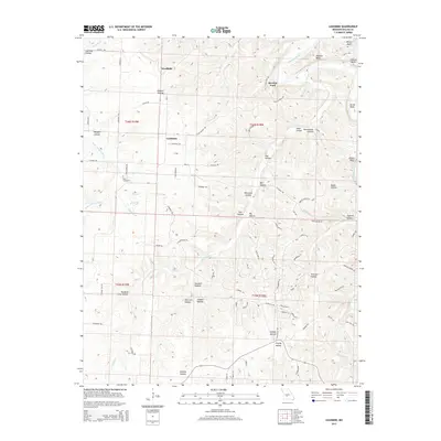
2015 Map of Leadmine
USGS Topo · Published 2015About this map
Niangua River and Little Niangua River carve through the Missouri landscape in this 2015 study, defining a region where small settlements and extractive industries once shaped the land. The hamlet of Leadmine serves as a central point of interest, its name hinting at the area's mineral history further evidenced by Smelter Hollow and Sawmill Hollow to the south.
Find a feature on this map
99 named features on this map. Tap any name to fly to it.
Don’t see what you’re looking for? This feature index may not catch every label — zoom into the map to look around manually.
Map Details
Editions of this 2015 Leadmine Map
This is the sole edition of this map. No revisions or reprints were ever made.
Other maps of this area

1884 · Bolivar
USGS Topo · 1:125,000

1892 · Bolivar
USGS Topo · 1:125,000

1934 · Macks Creek
USGS Topo · 1:48,000

1939 · Macks Creek
USGS Topo · 1:62,500

1939 · Long Lane
USGS Topo · 1:62,500

1942 · Long Lane
USGS Topo · 1:62,500

1954 · Springfield
USGS Topo · 1:250,000

1958 · Springfield
USGS Topo · 1:250,000

1959 · Springfield
USGS Topo · 1:250,000
1960 · Branch
USGS Topo · 1:24,000