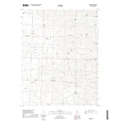
2017 Map of Leadmine
USGS Topo · Published 2017About this map
Leadmine stands as the primary community in this portion of Dallas County, situated near the headwaters of numerous hollows that drain toward the Niangua River. The landscape is defined by its deep drainage patterns and namesake bluffs, such as Osborn Bluff and Webster Bluff, which overlook the river's winding path. This area represents a transition from upland agriculture to the dense network of ravines typical of the region's topography.
Find a feature on this map
101 named features on this map. Tap any name to fly to it.
Don’t see what you’re looking for? This feature index may not catch every label — zoom into the map to look around manually.
Map Details
Editions of this 2017 Leadmine Map
This is the sole edition of this map. No revisions or reprints were ever made.
Other maps of this area

1884 · Bolivar
USGS Topo · 1:125,000

1892 · Bolivar
USGS Topo · 1:125,000

1934 · Macks Creek
USGS Topo · 1:48,000

1939 · Macks Creek
USGS Topo · 1:62,500

1939 · Long Lane
USGS Topo · 1:62,500

1942 · Long Lane
USGS Topo · 1:62,500

1954 · Springfield
USGS Topo · 1:250,000

1958 · Springfield
USGS Topo · 1:250,000

1959 · Springfield
USGS Topo · 1:250,000
1960 · Branch
USGS Topo · 1:24,000