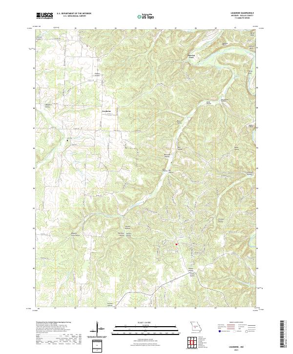
2021 Map of Leadmine
USGS Topo · Published 2021About this map
The Niangua River and the Little Niangua River carve a complex landscape of bluffs and hollows through this portion of Dallas County. The settlement of Leadmine serves as a central point, situated near a network of roads like State Hwy T and Leadmine Rd. The river’s path is defined by prominent natural landmarks such as Berry Bluff, Webster Bluff, Callison Bluff, and Turner Bluff, which rise above the water at the eastern edge of the quadrangle. Early transport and community life are evidenced by Herrick Ford and the Kirk Cem located along Lane Br.
Find a feature on this map
98 named features on this map. Tap any name to fly to it.
Don’t see what you’re looking for? This feature index may not catch every label — zoom into the map to look around manually.
Map Details
Editions of this 2021 Leadmine Map
This is the sole edition of this map. No revisions or reprints were ever made.
Other maps of this area

1884 · Bolivar
USGS Topo · 1:125,000

1892 · Bolivar
USGS Topo · 1:125,000

1934 · Macks Creek
USGS Topo · 1:48,000

1939 · Macks Creek
USGS Topo · 1:62,500

1939 · Long Lane
USGS Topo · 1:62,500

1942 · Long Lane
USGS Topo · 1:62,500

1954 · Springfield
USGS Topo · 1:250,000

1958 · Springfield
USGS Topo · 1:250,000

1959 · Springfield
USGS Topo · 1:250,000
1960 · Branch
USGS Topo · 1:24,000