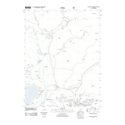
2011 Map of Leadville North
USGS Topo · Published 2011About this map
Leadville and its high-altitude surroundings are defined by a dense legacy of hard-rock mining and water management. The landscape is carved by countless mines and shafts, including the Jennie June Mine, Turquoise Chief Mine, and the complex network surrounding Stray Horse Gulch. The residential expansion of the town is evident along streets like Mount Massive Dr and Lodestone Dr, while the historic Evergreen Cemetery rests on the western edge of the settlement.
Find a feature on this map
133 named features on this map. Tap any name to fly to it.
Don’t see what you’re looking for? This feature index may not catch every label — zoom into the map to look around manually.
Map Details
Editions of this 2011 Leadville North Map
This is the sole edition of this map. No revisions or reprints were ever made.
Other maps of this area

1889 · Leadville
USGS Topo · 1:125,000

1891 · Leadville
USGS Topo · 1:125,000

1934 · Climax
USGS Topo · 1:48,000

1935 · Mount Elbert
USGS Topo · 1:62,500

1938 · Mt. Lincoln
USGS Topo · 1:48,000

1938 · Mount Elbert
USGS Topo · 1:62,500

1939 · Mount Elbert
USGS Topo · 1:62,500

1942 · Leadville
USGS Topo · 1:125,000

1945 · Mount Lincoln
USGS Topo · 1:62,500

1949 · Holy Cross
USGS Topo · 1:62,500