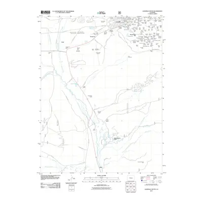
2011 Map of Leadville South
USGS Topo · Published 2011About this map
Leadville sits at the northern edge of this high-altitude landscape, where the concentrated mining infrastructure of the late 19th and early 20th centuries meets the headwaters of the Arkansas River. The map reveals an incredible density of historic mining claims east of the city, particularly surrounding Carbonate Hill and Iron Hill. Here, dozens of individual operations like the Only Chance Mine, Bessie Wilgus Shaft, and Moffat Mine illustrate the intense subsurface exploration that defined the region’s silver and lead booms.
Find a feature on this map
164 named features on this map. Tap any name to fly to it.
Don’t see what you’re looking for? This feature index may not catch every label — zoom into the map to look around manually.
Map Details
Editions of this 2011 Leadville South Map
This is the sole edition of this map. No revisions or reprints were ever made.
Other maps of this area

1889 · Leadville
USGS Topo · 1:125,000

1891 · Leadville
USGS Topo · 1:125,000

1934 · Climax
USGS Topo · 1:48,000

1935 · Mount Elbert
USGS Topo · 1:62,500

1938 · Mt. Lincoln
USGS Topo · 1:48,000

1938 · Mount Elbert
USGS Topo · 1:62,500

1939 · Mount Elbert
USGS Topo · 1:62,500

1942 · Leadville
USGS Topo · 1:125,000

1945 · Mount Lincoln
USGS Topo · 1:62,500

1949 · Holy Cross
USGS Topo · 1:62,500