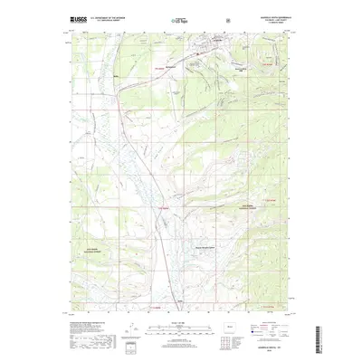
2019 Map of Leadville South
USGS Topo · Published 2019About this map
The high-altitude mining landscape of Lake County is centered here on Leadville, where legacy industrial sites meet modern recreational trails. Mining history is etched into the terrain at Carbonate Hill and Iron Hill, while the Resurrection Mill stands near California Gulch, an area famous for the silver boom that transformed this region. The settlement of Malta and the southern reaches of the city are bounded by the Arkansas River, which is fed by complex water systems like the Derry Number 1 Ditch and De Lappe Henderson Ditch. Modern land use is reflected in the Colorado Mountain College Timberline Campus and the Lake County Airport. Within the San Isabel National Forest, the landscape transitions from historic gulches to a network of contemporary paths, including the Sawatch Range Trail and various routes of the Leadville Race Series, illustrating how former haul roads and mining tracks have been repurposed for world-class endurance sports.
Find a feature on this map
67 named features on this map. Tap any name to fly to it.
Don’t see what you’re looking for? This feature index may not catch every label — zoom into the map to look around manually.
Map Details
Editions of this 2019 Leadville South Map
This is the sole edition of this map. No revisions or reprints were ever made.
Other maps of this area

1889 · Leadville
USGS Topo · 1:125,000

1891 · Leadville
USGS Topo · 1:125,000

1934 · Climax
USGS Topo · 1:48,000

1935 · Mount Elbert
USGS Topo · 1:62,500

1938 · Mt. Lincoln
USGS Topo · 1:48,000

1938 · Mount Elbert
USGS Topo · 1:62,500

1939 · Mount Elbert
USGS Topo · 1:62,500

1942 · Leadville
USGS Topo · 1:125,000

1945 · Mount Lincoln
USGS Topo · 1:62,500

1949 · Holy Cross
USGS Topo · 1:62,500