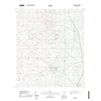
2020 Map of Leakesville
USGS Topo · Published 2020About this map
Leakesville serves as the focal point of this Greene County landscape, centered on the Greene County Courthouse and the surrounding street grid. The town's connection to the regional economy is evidenced by the Mississippi Export RR running through the southern district, while the Chickasawhay River meanders to the east, carving out dramatic riverine features like Meeting House Bluff, Churchwell High Bluff, and Ferry Bend. The surrounding terrain transitions from the wetland-heavy basins of McInnis Lake and Cutoff Lake to the elevations of the Jane Hills in the north.
Find a feature on this map
121 named features on this map. Tap any name to fly to it.
Don’t see what you’re looking for? This feature index may not catch every label — zoom into the map to look around manually.
Map Details
Editions of this 2020 Leakesville Map
This is the sole edition of this map. No revisions or reprints were ever made.
Other maps of this area

1942 · Deer Park
USGS Topo · 1:62,500

1943 · Deer Park
USGS Topo · 1:62,500

1953 · Hattiesburg
USGS Topo · 1:250,000

1958 · Hattiesburg
USGS Topo · 1:250,000

1964 · Clark
USGS Topo · 1:24,000

1964 · Avera
USGS Topo · 1:24,000

1972 · Leakesville
USGS Topo · 1:24,000
1972 · Vernal
USGS Topo · 1:24,000

1973 · Jonathan
USGS Topo · 1:24,000
1973 · Leakesville SW
USGS Topo · 1:24,000